Researchers Extract First Layered Lake-Sediment Sample from Subglacial Antarctica
Scripps Oceanography alumnus and colleagues describe the sample's importance in understanding past dynamics of the Antarctic ice sheet and its ecosystems
Story by:
Published Date
Article Content
Since the discovery 50 years ago of subglacial lakes in Antarctica—some of the least accessible geological features on Earth—scientists have attempted to extract lake bed sediment to learn about the formation, movement, and past conditions of the ice sheet. Now, a team of researchers with the National Science Foundation-funded project Subglacial Antarctic Lakes Scientific Access (SALSA) has successfully done so, recovering the first layered sediments from beneath the modern Antarctic ice sheet.
The researchers’ findings from analysis of the sediment sample, published March 9 in Geology, give important insight into the larger dynamics of the Antarctic ice sheet and its history, including when the ice sheet was smaller than its current size. Their work adds to the sedimentary record of knowledge of Antarctica and also holds implications for understanding how Antarctica may contribute to global sea level change.
The study was led by authors at the Colorado School of Mines, with a large team of co-authors from more than 20 other scientific research organizations, including UC San Diego’s Scripps Institution of Oceanography, which was instrumental in leading the SALSA project.
Previous studies of modern subglacial lakes were limited to the timescale of the modern ice sheet due to the challenge of sampling an environment locked beneath thousands of feet of ice. The sediment sample extracted by the SALSA team will allow researchers to better understand subglacial activity across almost two centuries, instead of merely two decades.
“There are places on Earth that we still haven’t explored,” said Matthew Siegfried, assistant professor of geophysics at Colorado School of Mines and a lead author of the paper. “We have now one sample trying to understand an environment that is one-and-a-half times the size of the continental United States. It’s like pulling up a rock in New Orleans and understanding how the Mississippi River and its entire basin has acted for the past 1,000 years.”
Siegfried began working on the SALSA project while a postdoctoral researcher at Scripps Oceanography, where he studied with glaciologist Helen Amanda Fricker, a co-author of the new study, and helped write the original proposal. Fricker said that the recent recovery of subglacial lake-sediment builds upon previous discoveries made possible by NASA’s ICESat satellite, which once orbited more than 370 miles above the surface of the earth, measuring surface elevation of large ice sheets.
Active lakes under ice streams in Antarctica, like the one sampled by the SALSA Project, were not known about until 2006 when ICESat laser altimetry detected meter-scale changes in the ice surface which were caused by the transfer of water from one lake to another.
“The satellite data pointed us to where we needed to go, then we were able to write a proposal to go and drill into two of those lakes and learn more about the system,” said Fricker. “When we first discovered active subglacial lakes in 2006, two big questions were ‘How long have they been there?’ and ‘How often do they drain?’ It’s so exciting to me that this serendipitous discovery has set off this entire research program. The recovery of a layered sediment from the bottom of one of these lakes 12 years later moves us closer to answering both of these questions."
Ryan Venturelli, assistant professor of geology and geological engineering at Colorado School of Mines and a lead author on the paper, also described the importance of the ICESat data.
“Thanks to satellites that have helped us spy on Antarctica from space since 2003, we have a deep understanding of subglacial lake activity in the modern record, but the sediments we collected as part of SALSA give us an idea of how persistent these features are on a much longer timescale—hundreds of years. It's our first insight into the life cycle of an active subglacial lake, and that is really exciting,” said Venturelli.
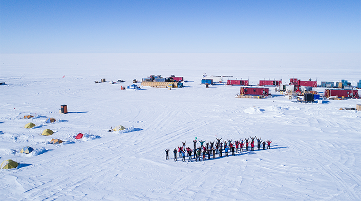
The saga of the SALSA team’s quest to explore subglacial lakes is chronicled in “The Lake at the Bottom of the World,” a feature-length documentary film released across multiple streaming platforms on Feb. 28 by the team in partnership with Metamorph Films. The NSF-funded film gives viewers a close look at how the scientists conducted their work amid harsh Antarctic conditions.
‘Like grabbing a package of soup’
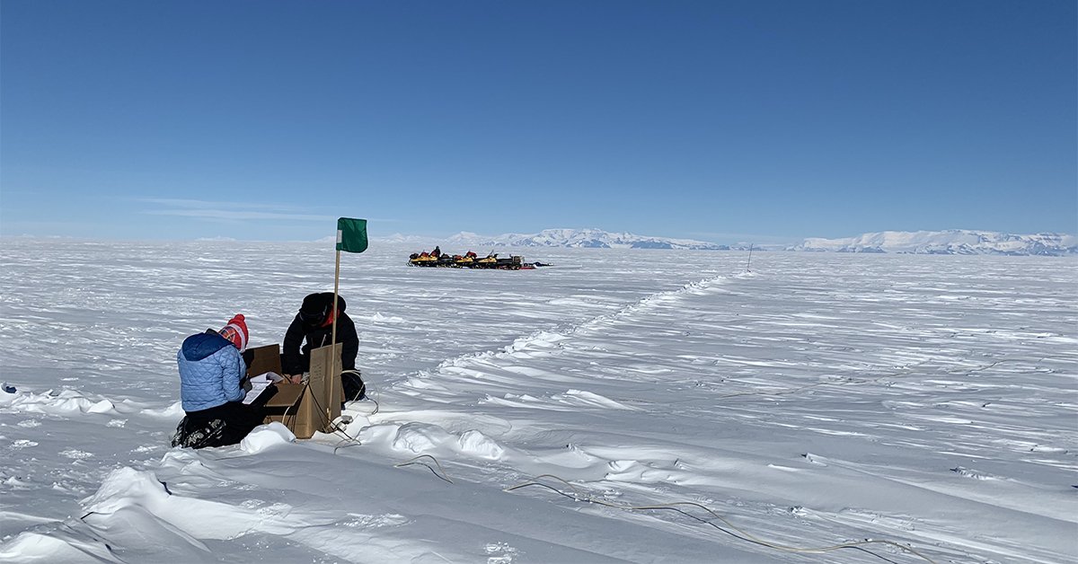
Researchers captured the sediment sample on a field expedition in December 2018. They cleanly bored a hole through over 3,500 feet of ice over Mercer Subglacial Lake by filling a modified fire hose with sterilized water at nearly 200°F and aiming it into the ice. They carefully collected sediment cores through a borehole that was constantly freezing back in using a device modified from its typical use in “normal” lakes to fit in a narrow ice borehole.
Members of the SALSA team in the field, with their campsite shown on the left. Photo: Billy Collins
While researchers knew that even the mere extraction of the sediment from the lake would be a success, the fact that a sample arrived at the lab intact proved even more gratifying.
“We didn’t expect to find this mushy, fragile sediment under the ice sheet,” Siegfried said. “It was basically like grabbing a package of soup, bringing it up 1,100 meters to the surface of the ice, shipping it to America, getting it into a CT scanner in Oregon, and somehow maintaining tiny laminations in the sample.”
Previous sediment samples from beneath the modern West Antarctic Ice Sheet have only consisted of a jumbled mixture of marine muds and rocks left behind when glaciers move over the Earth and do not contain a layered history of the region or ice sheet.
“In a 2001 paper published after a decade of subglacial drilling efforts in Antarctica, glaciologist Barclay Kamb somewhat unenthusiastically summarizes that everywhere the project sampled sediments, they found the same uninteresting, sticky, gray mixture,” said Venturelli. “We found that, too. But above that same sticky, gray stuff, we found something different for the first time.”
Understanding subglacial movement
CT imagery of the sample showed a pattern of contrasts that indicated the subglacial lake was filling and draining with water before the scientists’ observational record. This finding offers insight into how long water has been moving under this part of Antarctica—movement that has implications for how the ice sheet moves and contributes to sea level rise. The life cycle of subglacial lakes derived from these contrasts also will enable researchers to better identify how carbon, nutrients and dissolved gasses are transported through the subglacial system to the global ocean.
“We use sediments from normal (subaerial) lakes all the time to build records of regional changes in climate. Subglacial lakes are different, because they are sealed by an overlying ice sheet that shields them from changing seasons and changing climate. Any variation in the subglacial sediment record is driven by changes to the overlying ice sheet and associated water system,” Venturelli said.
The study was supported by the National Science Foundation (grants 0636970, 0838885, 1327315, 1543347, 1543405, 1543441, 1543537, 1832109, 1832170, and 1836328) and NASA (grants 80NSSC20K1734 and 80NSSC21K0912), with radar support and instrumentation provided by the Australian Antarctic Division and the Australian Antarctic Program Partnership.
– Adapted from the Colorado School of Mines
Learn more about research and education at UC San Diego in: Climate Change
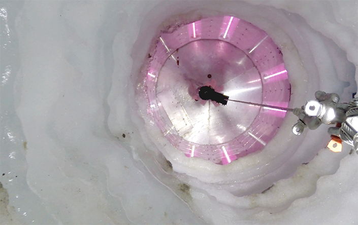
Researchers captured the sediment sample in 2018 by cleanly boring a hole through over 3,500 feet of ice over Mercer Subglacial Lake. Here, a UV collar lights up the borehole. Photo: Kathy Kasic
Share This:


Stay in the Know
Keep up with all the latest from UC San Diego. Subscribe to the newsletter today.