By:
Published Date
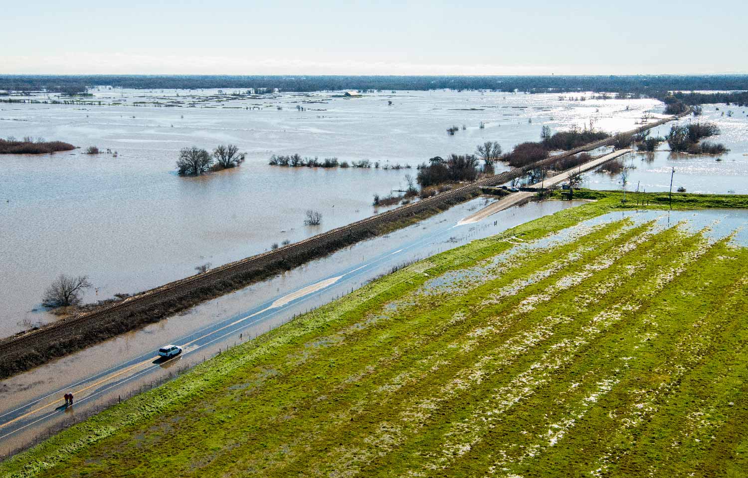
An intersection in Elk Grove, Calif. is flooded after January storms. Photo: Florence Low/California Department of Water Resources
What Kind of La Niña Year Is This?
Atmospheric rivers steal thunder from phenomenon that usually brings dry weather to the Southwest
Scientists had been anticipating since last summer that La Niña, the phenomenon often associated with dry and somewhat cool weather on the West Coast, would develop this winter and extend a five-year drought across the Southwest.
But as it turns out, La Niña, yin to El Niño’s yang, has decided to stay home this year. Cool waters in the eastern half of the tropical Pacific were relatively weak—barely registering as a La Niña. NOAA’s Climate Prediction Center looks for a sustained period of eastern Pacific Ocean surface temperatures falling 0.5° C below average before officially designating La Niña winters. Researchers at UC San Diego’s Scripps Institution of Oceanography and elsewhere have their doubts that criterion will be met.
Instead, the real story this winter has been the occurrence of a series of short storm bursts that have amounted to California’s best water year since 2011. January 2017 will likely be remembered as a classical drought-busting episode that has inundated California and Nevada. While State officials are reluctant to declare an end to the drought because some depleted water stocks take years to replenish, much of the dryness has been reversed.
The season has delivered a variety of superlatives: In a matter of a long January weekend, the state’s snowpack levels climbed from 65 percent of average to 150 percent and began February at 173 percent. The month saw the northern Sierra Nevada receiving 60 centimeters (23.6 inches) of rain, nearly three times the 22-centimeter (8.9-inch) average for January. And only twice before in history has the Sacramento River watershed – a linchpin of state water supply – reached its yearly average rainfall amount so early in the year.
“This winter, along with the several years preceding it are emblematic of California’s natural water supply,” said Scripps climate researcher Dan Cayan, “California’s hydroclimate is extremely volatile, lurching from dry to wet on an irregular basis.”
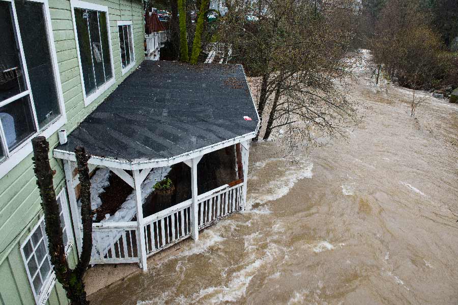
Lefty's Grill in Nevada City, Calif. closed due to flooding from nearby Deer Creek, which drains to the Yuba River, during the atmospheric river event in Northern California on Jan. 10, 2017. Photo: Kelly M. Grow/California Department of Water Resources
The attention of scientists has turned from the withering La Niña to the distinctive channels of moisture known as “atmospheric rivers” that have delivered much of the recent near-record precipitation. The streams of water vapor that travel over the Pacific Ocean can form just as easily in La Niña years as El Niño years. U.S. Geological Survey scientist and Scripps research associate Mike Dettinger, studying an archive of past dry events, found that more often than not, atmospheric rivers have been instrumental in terminating West Coast droughts, sometimes in spectacular fashion, and this year has been no exception.
The incomplete formation of La Niña is one reason why. Even if the ocean does live up to the standard of what a La Niña should be, Scripps climate researcher David Pierce said the atmosphere never did its part this time around. Typically, La Niña manifests itself as a cooling of the eastern Pacific Ocean surface temperature coupled with a change in Pacific-North American atmospheric pressure patterns. This year the atmospheric change never happened.
“We don’t yet have a good grasp why antecedent conditions could seem to be primed but just not pan out and that’s what needs to be better understood,” he said.
Scripps climate researcher Art Miller said that last year’s intense El Niño just left too much residual energy in its wake for La Niña to fully emerge. Also, though La Niña years are drier on average, there are still plenty of examples in the historical record in which La Niña years saw greater-than-average precipitation in California, he said. The unpredictability ultimately has its origin in what Miller terms “the chaos of the mid-latitudes,” the myriad variables that can render any solid prediction invalid.
“The reality of the system is that it’s not as clear cut a relationship as people want to think it is,” Miller said.
A dominant pattern this early winter is well known to flood forecasters in the West. First described in 1962 by Robert Weaver, a meteorologist at the then-National Weather Bureau, it featured a “blocking” high-pressure system fixed over the Gulf of Alaska for much of January. As the name suggests, the center of high pressure is set up in a way that blocks other systems and forces them to go around it. In this case, the blocking high pushed storm tracks southward. Without it, California storms might otherwise have been directed at the Pacific Northwest.
The blocking high is part of a broader pattern in which Weaver classified as low-latitude storm tracks that target Northern and Central California. Weaver observed that, under these conditions, which only rarely occur, low-latitude storms may form a chain that extends from the Hawaiian Islands across the California coast. Formerly known as a “pineapple express,” work by Scripps climate researcher Marty Ralph and collaborators now identify these low-latitude, warm, moist air mass storm systems as atmospheric rivers.
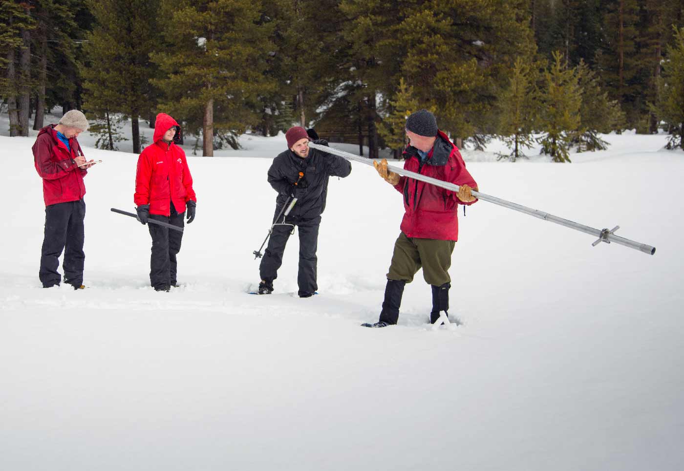
Members of the California Council on Science and Technology Science Policy Fellows left to right, Michael Peterson, Julianne McCall and Mikel Shybut assist Frank Gehrke, chief of the California Cooperative Snow Surveys Program with the second snow survey of the 2017 snow season Feb. 2 at Phillips Station in the Sierra Nevada mountains. Photo: Dale Kolke/California Department of Water Resources
For Ralph, this winter has provided a showcase of atmospheric rivers, a striking example of the phenomenon he has studied over the past 20 years. Building on pioneering studies of these extreme storms, Ralph joined Scripps in 2013 and created the Center for Western Weather and Water Extremes. Since then, he has worked with county and state officials to improve scientists’ ability to forecast atmospheric rivers and use that knowledge to manage reservoirs with greater accuracy.
In 2016, California Gov. Jerry Brown authorized the allocation of funds that will create a program proposed by a Northern California water agency that drew on science largely developed by Ralph and Scripps colleagues. The Atmospheric Rivers: Research, Mitigation, and Climate Forecasting Program could enable greater water supply reliability for reservoirs than is possible now. Researchers hope it will provide potent new information to support modern reservoir operations strategies now under development by the U.S. Army Corps of Engineers and other entities.
The program was authorized in 2014 with passage of a bill authored by State Sen. Marty Block. As that program comes online, Ralph said that previous investments by California are already providing a slew of new information from this year’s unexpected but welcome storms.
“No one else in the country has the ability to do what we do,” said Ralph. “The leadership of the governor and Senator Block is really setting California on a track to help water managers and emergency preparedness officials have greater control over their operations.”
Share This:


Stay in the Know
Keep up with all the latest from UC San Diego. Subscribe to the newsletter today.